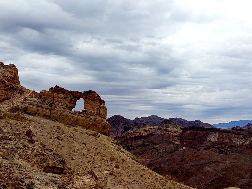
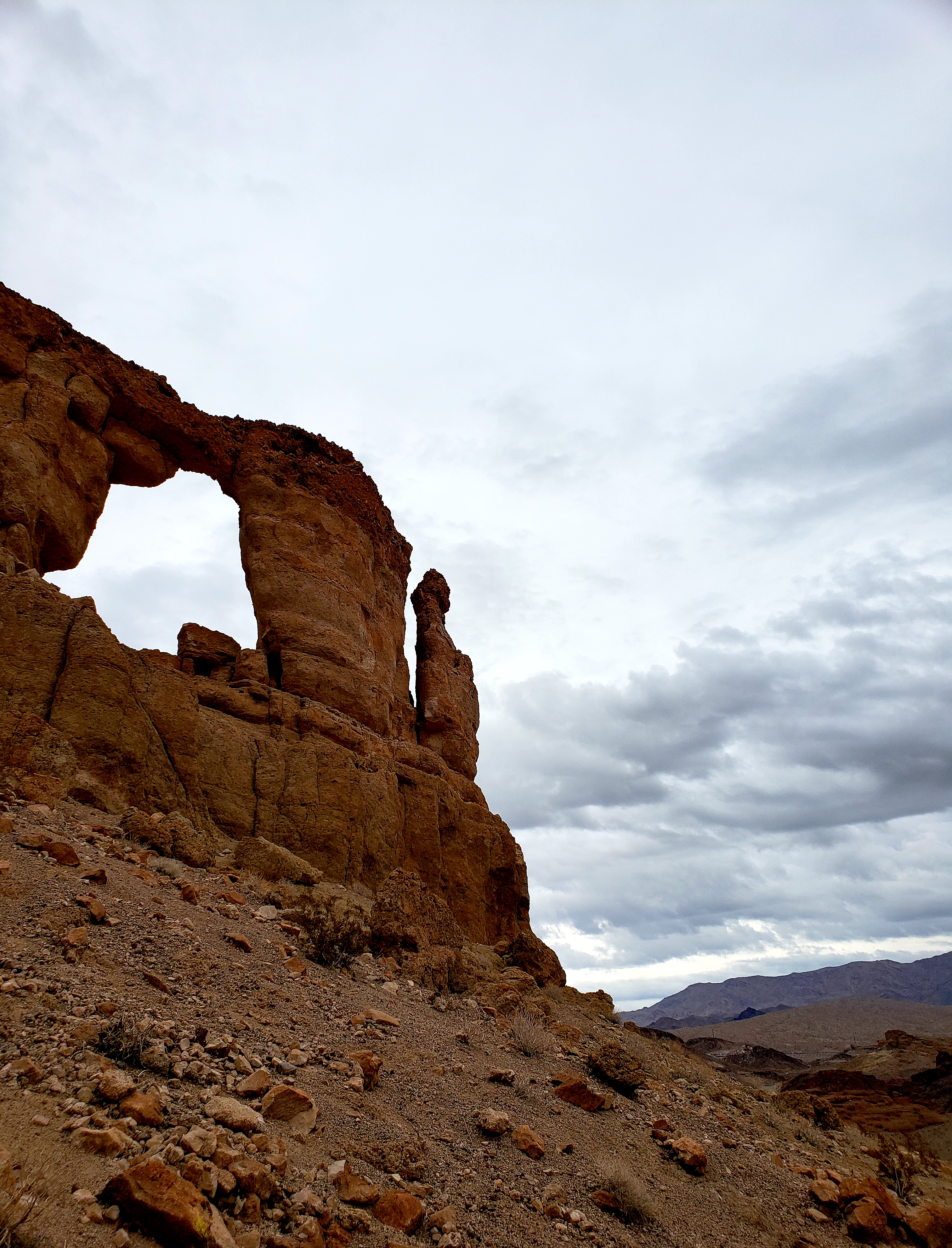
Liberty Bell Arch is named for it’s resemblance to the famous Liberty Bell in Pennsylvania. It even includes the “clapper”, or the round part of the bell that causes it to ring.Q
QUICK FACTS
- Liberty Bell Arch and hiking trail is in Mohave County, Arizona within Lake Mead National Recreation Area.
- The trailhead is located along Highway 93, south of the Hoover Dam, about 45 minutes from Las Vegas.
- The trail to the arch is a moderate hike, approximately 2 miles long.
- Traveling the entire trail out and back is +/- 4 miles, with an elevation gain of 1,000+ feet.
- The trail passes by an abandoned World War II era magnesium mine (relatively safe but use caution).
- The trail ends with a rewarding view atop a plateau known as the Colorado River Overlook.
- This trail also connects with the Arizona Hot Springs Hiking Trail.
- The trail is closed in the Summer months due to extreme temperatures. Check the status of the trail before you go!
- Please Respect Leave No Trace and Pack It In, Pack It Out Ethics.
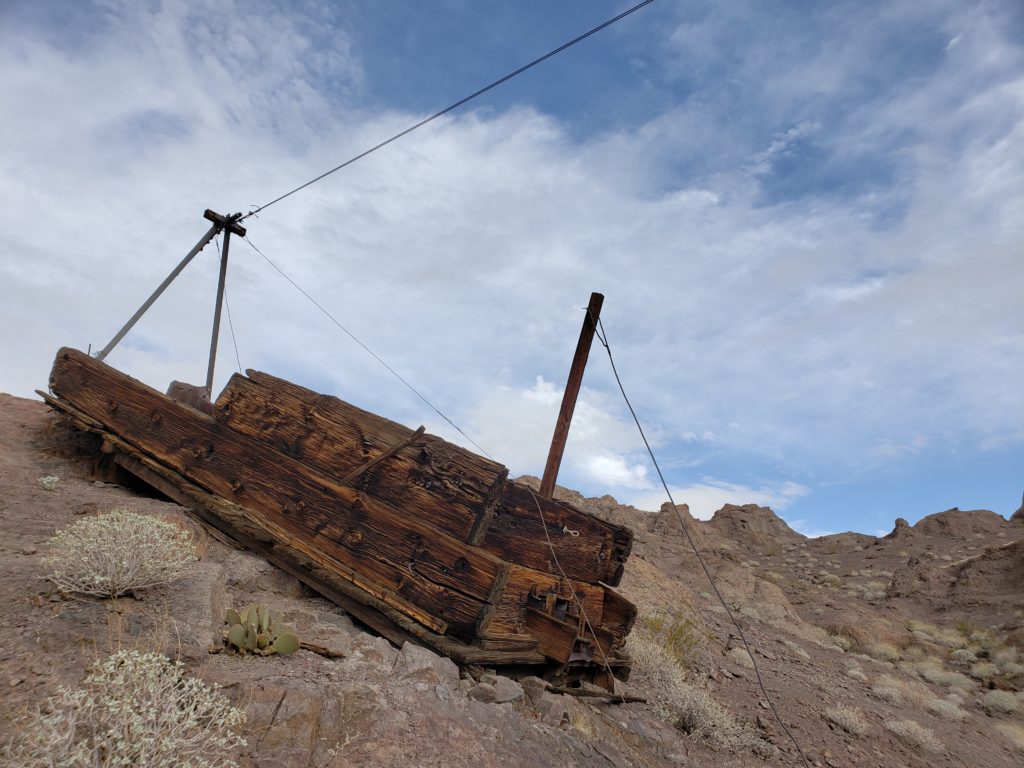
THE MINE
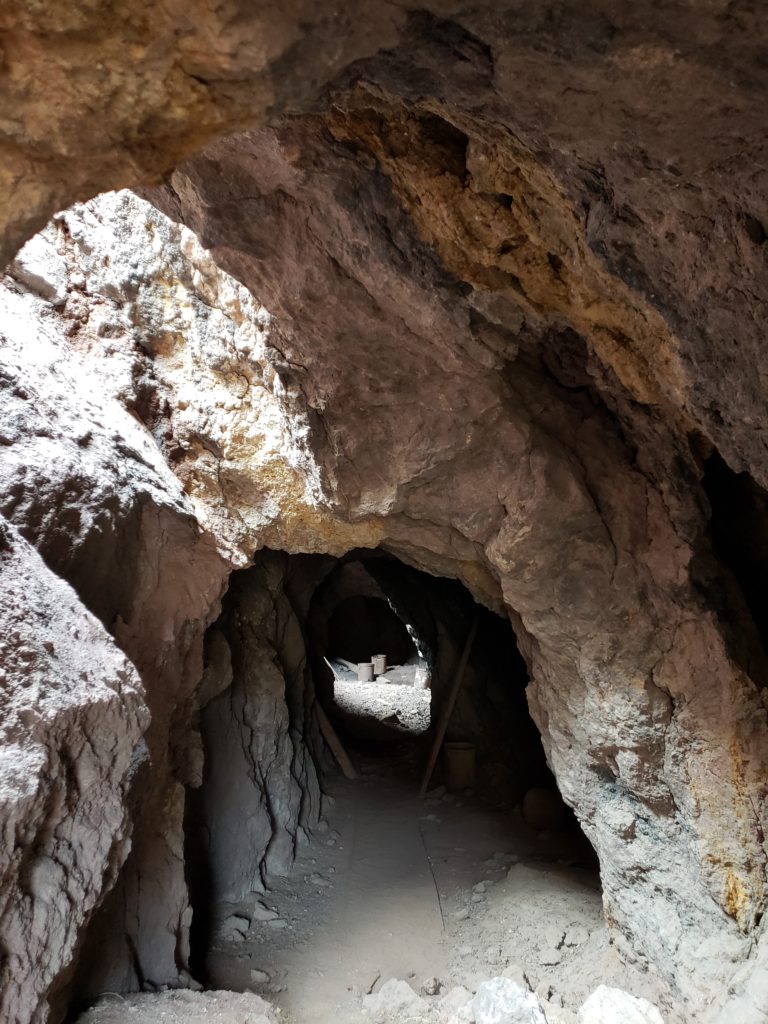
The Liberty Arch trail passes by an abandoned World War II era magnesium mine. There is an aerial cable with what appears to be a big, wooden cable car. The cable car is actually an old ore hopper (called “Noah’s Ark”) lying on the hillside.
This car was not moved on the cable – it was used as a loading chute. When the mine was in use, miners loaded ore into buckets and sent the buckets up the cable. The ore was then dumped into the wooden cable car and loaded into trucks that were driven up and parked under a chute below the cable car.
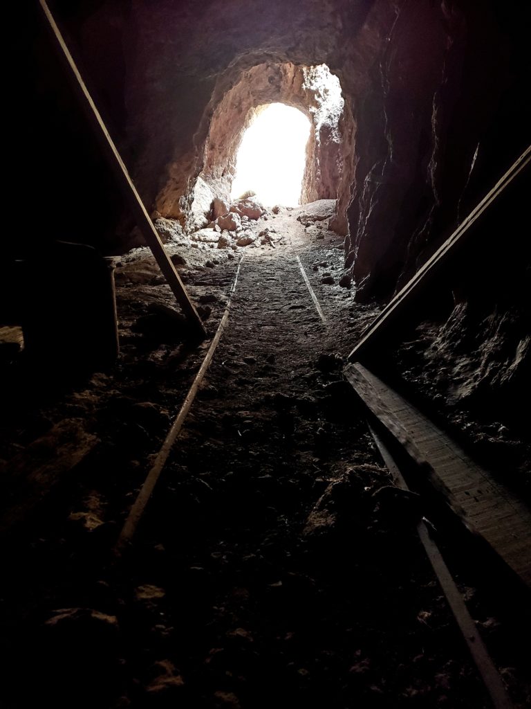
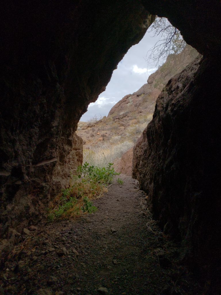
At the site there is a horizontal mine shaft that goes back roughly 50 – 60 feet. There are skylights, so you can walk all the way to the back without a flashlight.
Inside the mine, there are some tiny ore-car tracks, old metal buckets, wooden timbers on the ground, and old bore holes that the miners drilled before they gave up.
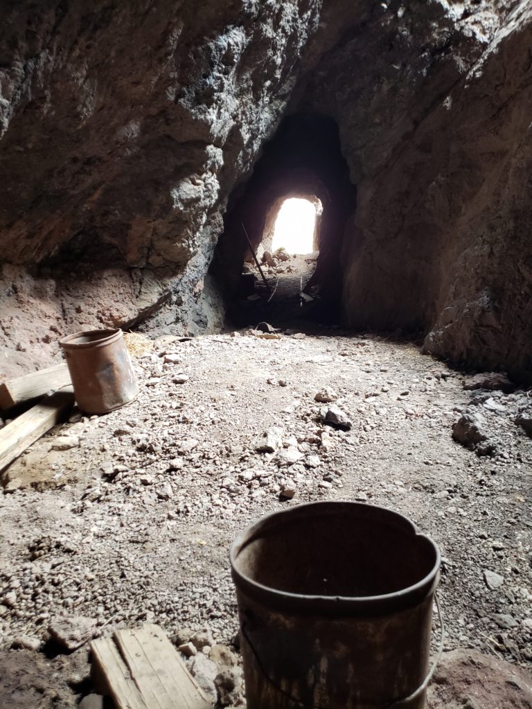
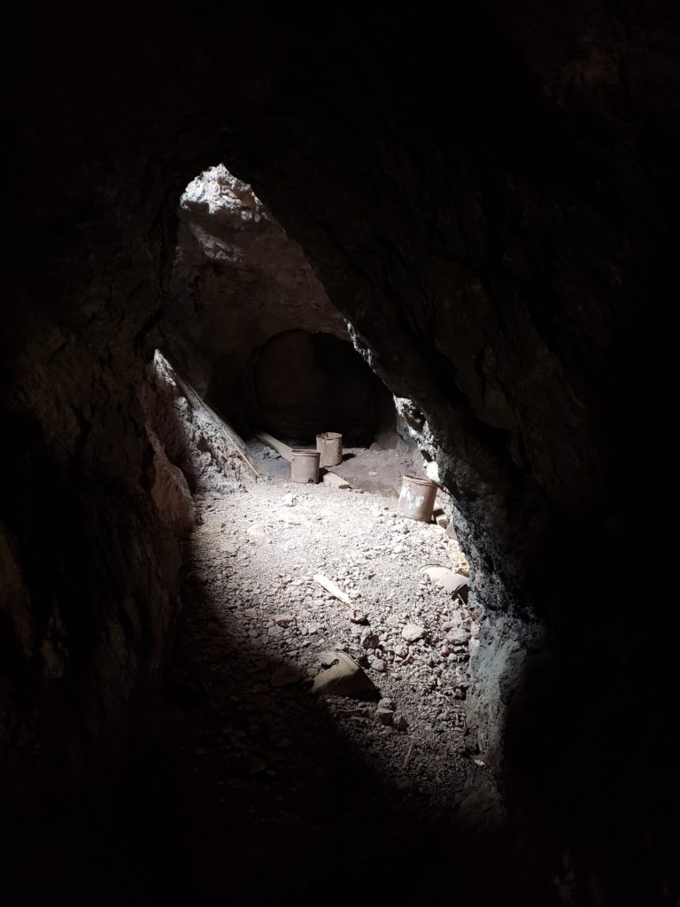
Outside the mine, there are more buckets, wooden timbers, junk, cables, the other end of the aerial cable, and other mining equipment lying around.
Just an FYI the site is protected, be respectful of the area and do not take or damage any of the historic objects!!!
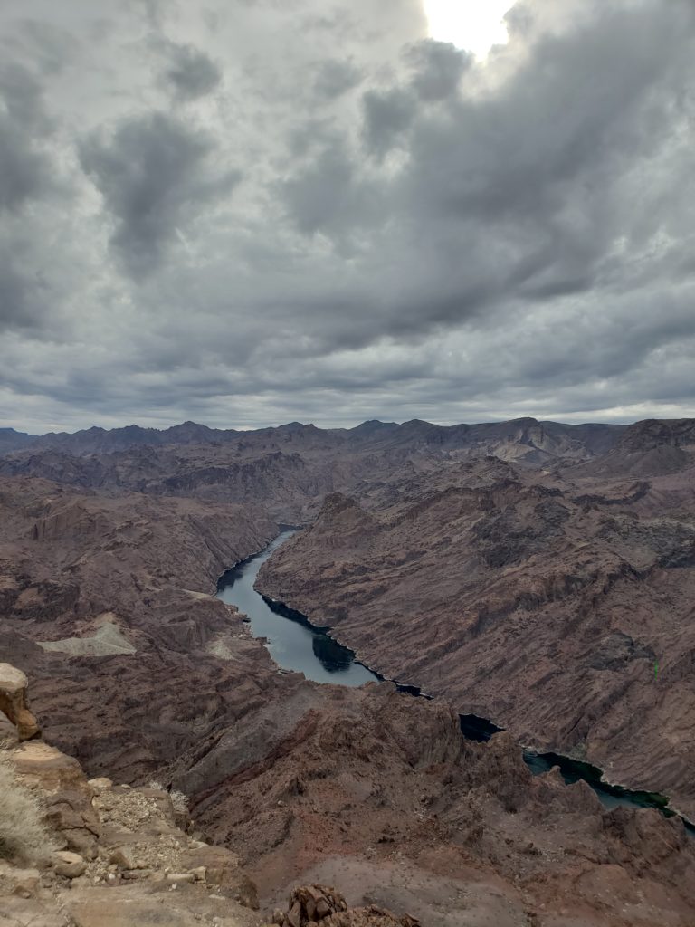
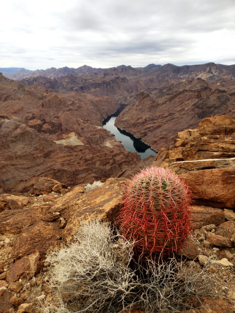
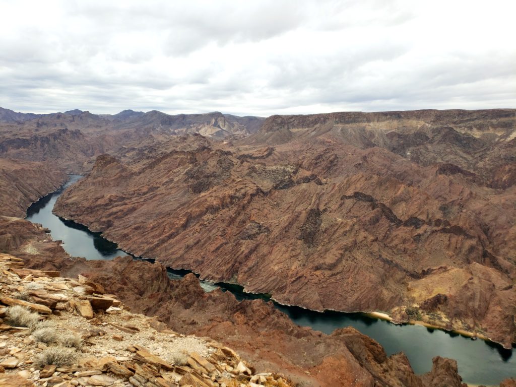
THE OVERLOOK
The end of the Liberty Bell Arch Trail ascends onto a wide plateau known as the Colorado River Overlook. From this vantage point, you can see the Colorado River 700 feet below you against the backdrop of stately brown cliffs.
CONCLUSION
This is a very reasonable, enjoyable hike. You can make it as long or short as you want, depending on what you want to see and how much time you want to spend exploring the area. This trail also connects to the Arizona Hot Springs Trail, another exciting trail that approaches the Colorado River and then progresses to hot springs in the area (I hope to write about them soon).
Liberty Bell Arch Trail has just enough elevation change to get your heart pumping. The landscape is spectacular from beginning to end – even on a cloudy day in January! If you are a photographer in any way, shape or form, make sure you allow yourself plenty of time to capture some beautiful images. Even though the main objective is the Liberty Bell Arch, the magnesium mine and the gorgeous finish at the Colorado River Outlook make this an attraction filled hike well worth seeing.